Jebel Shams
Jebel Shams
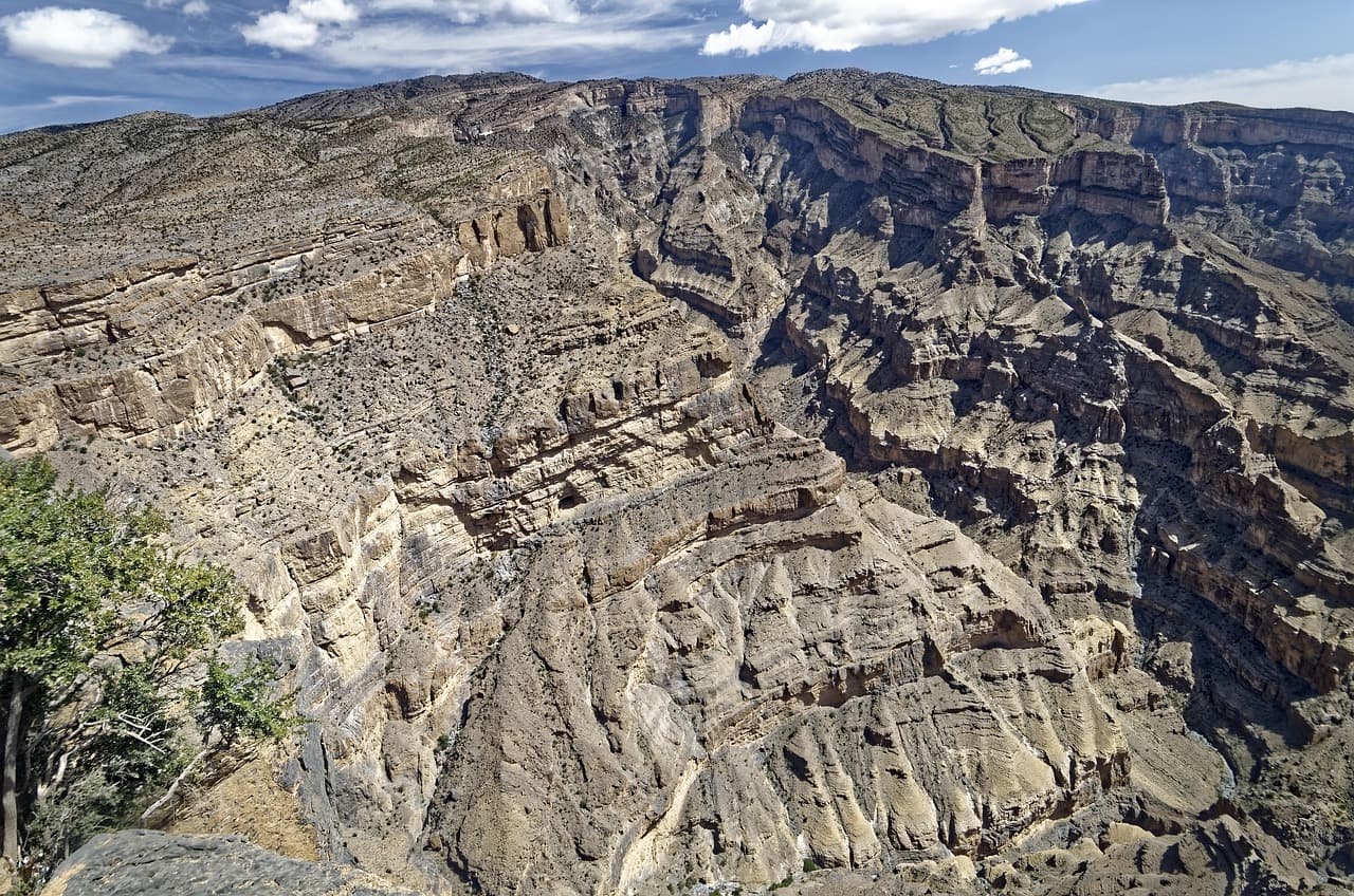
Jebel Shams, the roof of Oman at approximately 3,000 m, offers breathtaking views over Oman's Grand Canyon. The Balcony Walk trail traces the canyon's edge to the ruins of an abandoned village.
Jebel Shams is Oman's highest peak, rising to approximately 3,000 metres in the western Hajar range. Its name means "mountain of the sun". The site is primarily known for the Grand Canyon of Oman, a spectacular canyon that plunges several hundred metres below. Cool temperatures, desert panoramas and abandoned villages make it a singular destination in the country.
Quick practical information
- Access: paved road to the plateau; a 4×4 vehicle is recommended for certain secondary tracks.
- Clothing: warm garments essential in the evening and at night, even in summer — temperatures drop sharply at altitude.
- Recommended duration: a full day minimum; an overnight stay allows you to enjoy the sunrise.
- Accommodation: several lodges and campsites exist on the plateau (booking advised during peak season).
- Accessibility: the main viewpoint is accessible by car; hiking trails are unimproved.
What you'll see
The plateau offers direct views of the canyon, whose walls striped in red and ochre plunge vertically. The W4 trail (known as the "Balcony Walk") follows the canyon's edge for several kilometres and passes the ruins of the abandoned village of Sab Bani Khamis. In clear weather, the view extends across the Sharqiyah plains.
History and context
The villages clinging to Jebel Shams's slopes were inhabited by agricultural communities who cultivated in terraces. Most were abandoned during the twentieth century as inhabitants migrated to towns in the plains. The ruins of Sab Bani Khamis bear witness to this vernacular dry-stone architecture, adapted to the arid high-altitude climate.
Highlights of the visit
The Balcony Walk (W4 trail)
This hiking trail follows the canyon's edge for approximately 8 kilometres return. The elevation change is moderate but the terrain is rocky. It passes by former stone houses and offers direct visual plunges to the canyon floor.
The abandoned village of Sab Bani Khamis
Midway along the Balcony Walk, this deserted village preserves its stone houses, irrigation channels (falaj) and agricultural terraces. The state of preservation is remarkable. No tourist infrastructure on site: bring water.
Sunrise and sunset
The slanting light of morning and evening transforms the canyon walls. Colours shift from pale pink to deep orange. Spending the night on the plateau is the best way to experience it.
Photography tips
The main viewpoint, accessible by car, offers the most direct framing of the canyon. Morning light (an hour after sunrise) is ideal: it illuminates the walls without glare. On the Balcony Walk, the best angles are found at natural vantage points, about 2 km from the start. No known photography restrictions at the site.
Location and access
Jebel Shams is located in the Al Dakhiliyah Governorate, approximately 240 km from Muscat by road. The route passes through Nizwa, the main resupply point before the climb. From Nizwa, the road ascends toward Al Hamra then Misfat Al Abriyeen before reaching the plateau. The road is paved to the summit, though winding and steep. No regular public transport: car rental or organised tour required.
Nearby
- Nizwa — historic town with its seventeenth-century fort and souks selling pottery and khanjars (traditional daggers).
- Misfat Al Abriyeen — mountain village of stone, surrounded by palm groves and terraced gardens irrigated by falaj.
- Al Hamra — one of Oman's best-preserved villages, with its multi-storey mud-brick houses.
- Bahla — fortified town inscribed on the UNESCO World Heritage list, renowned for its pottery and immense fort.
Frequently asked questions
October to April brings pleasant daytime temperatures (15-25 °C) and cool nights. Summer (June-August) is manageable at altitude compared to the coast, but nights remain cold. Avoid the monsoon rain period (July-August) if you're planning to hike.
The main road to the viewpoint is paved and passable in a standard car. A 4×4 becomes useful if you wish to explore secondary tracks on the plateau or access less-frequented viewpoints.
The W4 trail is of moderate difficulty. The terrain is rocky and uneven, without sophisticated waymarking. Closed hiking shoes are essential. Bring sufficient water: no resupply points along the route.
Yes. Nizwa, Al Hamra and Misfat Al Abriyeen are easily visited on the way. A two to three-day tour from Muscat allows you to cover the entire Al Dakhiliyah region at a relaxed pace.
Several lodges and campsites are located on the plateau, near the viewpoint. Advance booking is recommended between November and March, the peak tourism season.
Warm clothing is essential for evenings and nights, whatever the season. Daytime calls for light clothing in summer. For hiking, favour closed shoes and a hat for sun protection.
Want to discover this destination?
Our local advisors design your tailor-made trip.